Remote Sensing Data
Analysis Services
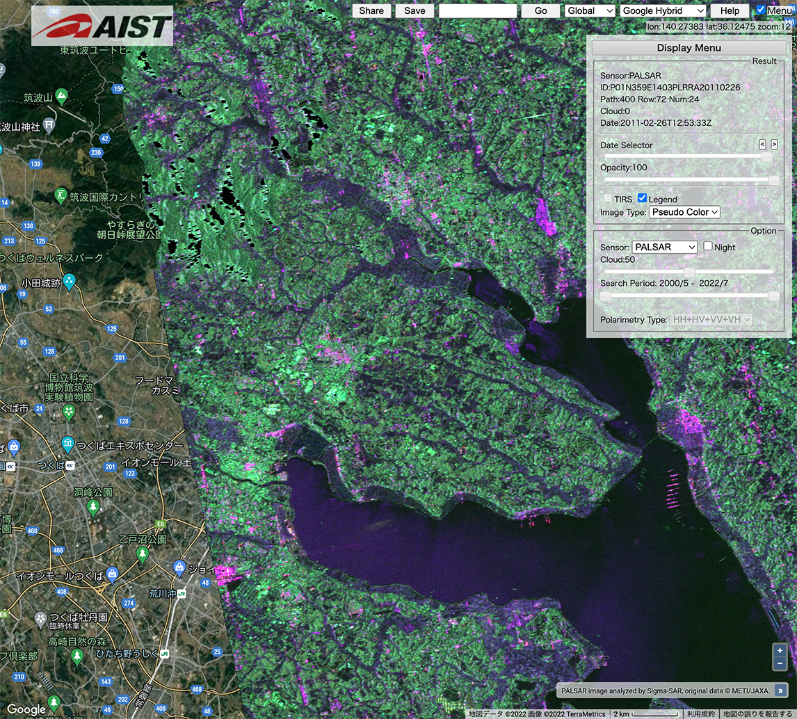
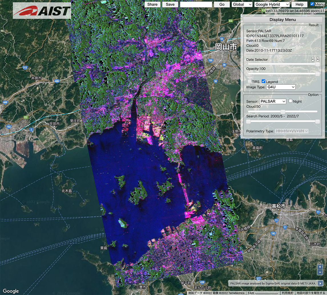
Synthetic Aperture Radar (SAR)
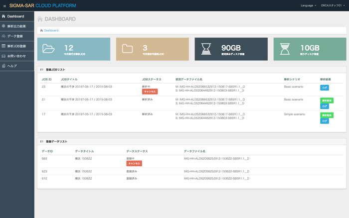
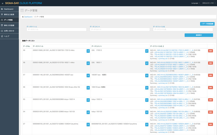
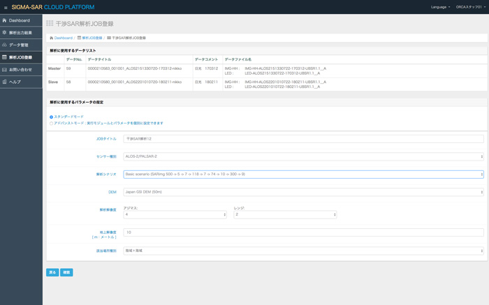
Sigma-SAR Analysis Platform (SSAP) is a service that provides an environment for analyzing earth observation satellite data. It especially supports the data analysis of Synthetic Aperture Radar (SAR) , which is highly useful for radar observation regardless of day, night or weather.
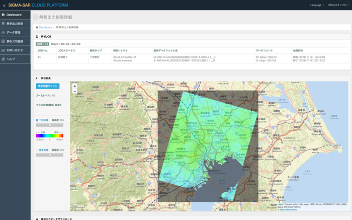
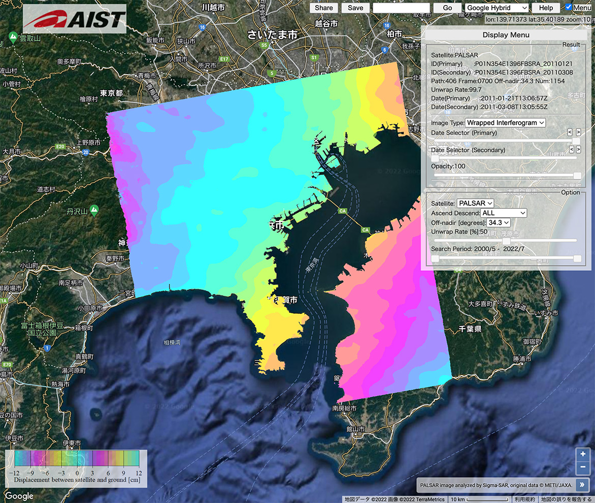
Interferometric analysis of your SAR data on the cloud generates an interferometric image that shows the land surface displacement that occurred across two periods. The regular interferometric SAR analysis over the long-term data offers you to see the signs of fine crustal land surface displacement or deformation.
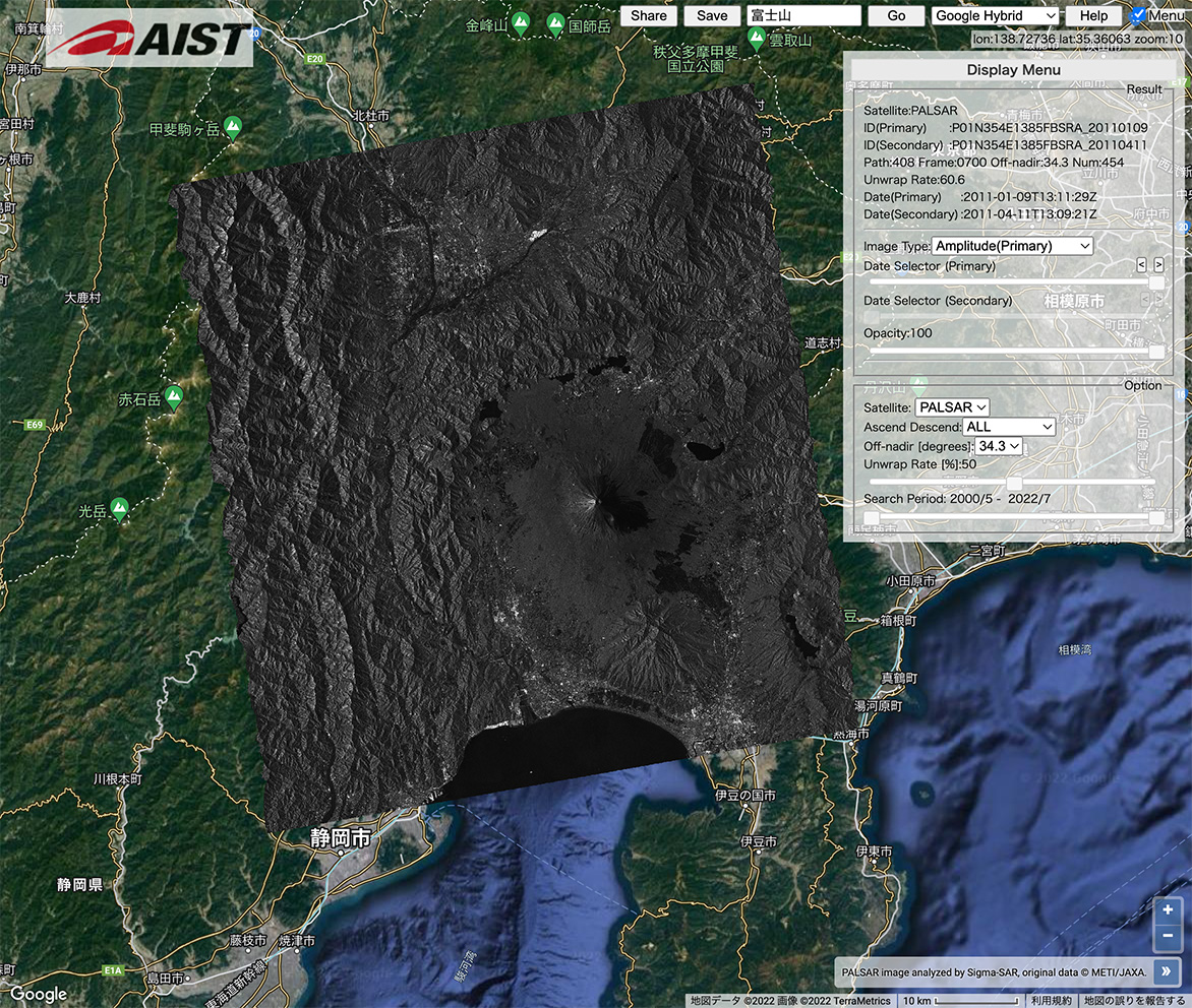
Imaging of the SAR data is performed. It uses our proprietary noise reduction technology to generate fine and high-resolution amplitude images. It also supports the mosaicking of images and the creation of time-series images. You can extract latitude and longitude of locations within the image.
"SSAP (Sigma-SAR Analysis Platform)", the integrated services for SAR data analysis, is developed and operated by Sigma-SAR Institute. The Sigma-SAR Institute was founded in November 2018 in order to provide solutions for spreading and effective utilization of SAR.